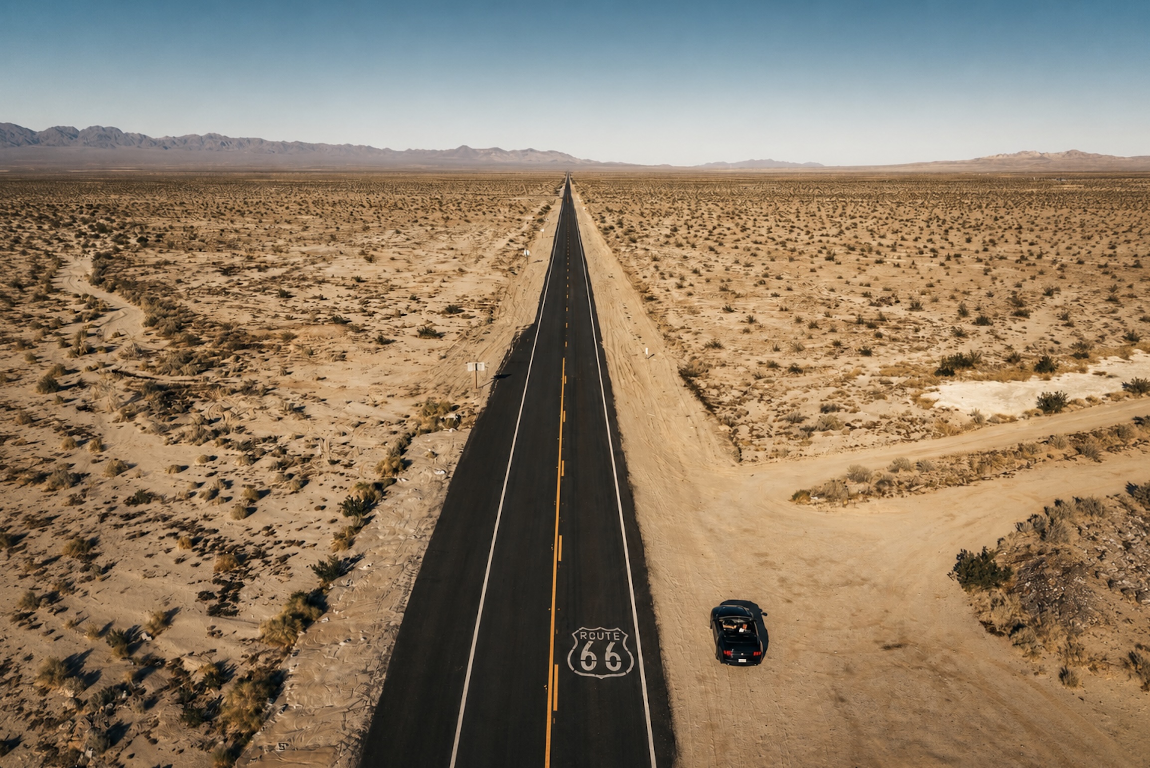
Before the Mother Road
Trails, Railroads & the Making of a Highway
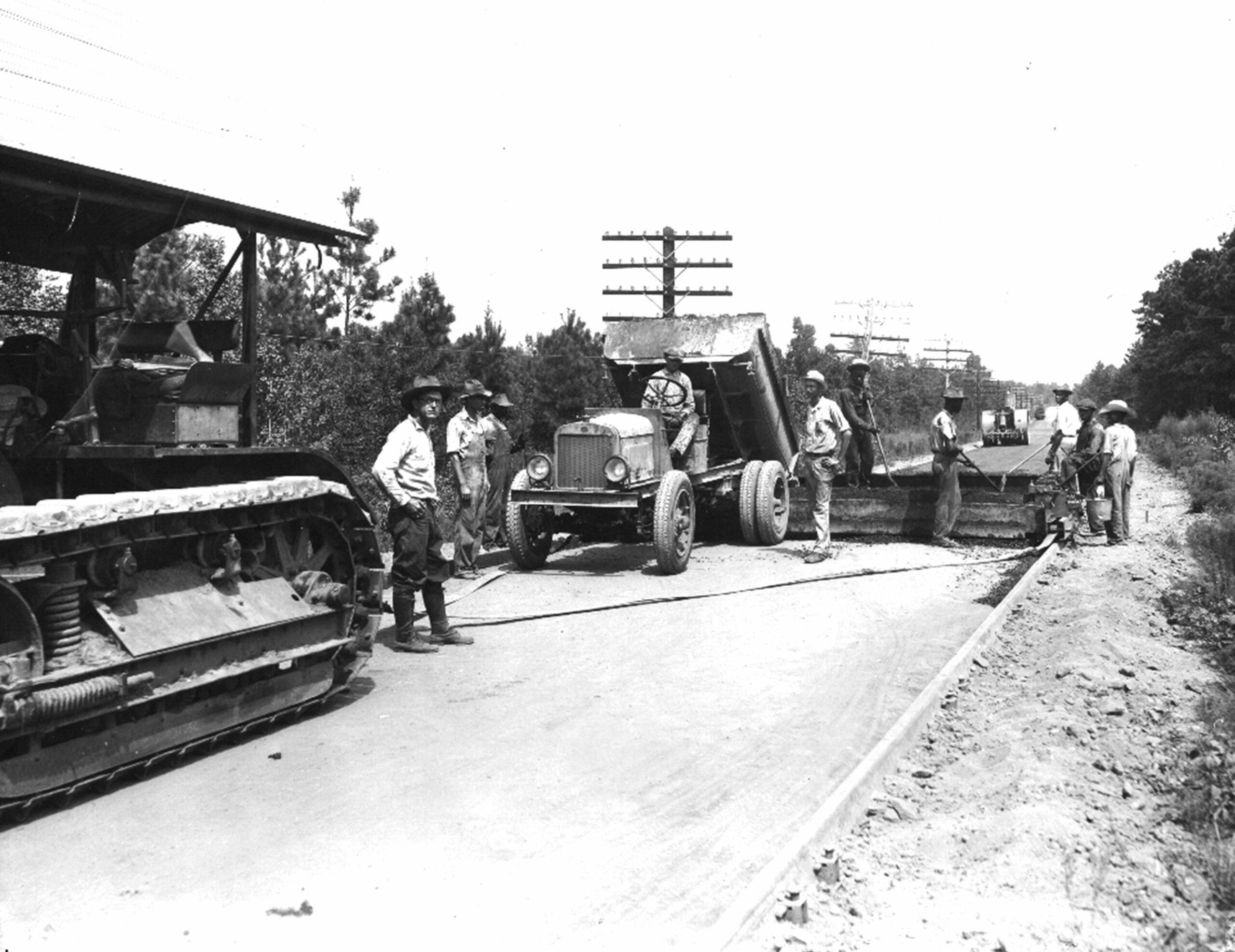
Photo Credit: Asphalt Institute
- Long before Route 66 existed, many portions of the roadway followed Native American trails and early pioneer routes.
- The National Old Trails Road heavily influenced the future alignment of Route 66 through the Southwest.
- The Ozark Trails influenced Route 66 through Missouri and Oklahoma.
- Much of western Route 66 later paralleled the tracks of the Atchison, Topeka and Santa Fe Railway.
- Railroad towns that later became Route 66 communities were established across the Southwest in the late 1800s.
- The Good Roads Movement of the late 1800s and early 1900s pushed for better roads across America.
- The popularity of the Ford Model T helped accelerate demand for a national highway system.
- The Federal Aid Road Act of 1916 became the first major federal highway funding law in U.S. history.
- The federal government began developing a numbered highway system during the 1920s to simplify navigation for motorists.
- Cyrus Avery from Tulsa, Oklahoma, became one of the strongest advocates for a Chicago-to-Los Angeles highway. He reportedly favored the number "66" because it was easy to pronounce and remember.
1926: The Birth of Route 66
America Gets a New Road
- The U.S. Highway System officially established Route 66 on November 11, 1926.
- Springfield, Missouri later became known as the "Birthplace of Route 66."
- Route 66 originally stretched approximately 2,448 miles.
- Route 66 crossed eight states: Illinois, Missouri, Kansas, Oklahoma, Texas, New Mexico, Arizona, and California.
- Only about 13 miles of Route 66 passed through Kansas.
- Route 66 crosses three different time zones: Central, Mountain, and Pacific.
- Early portions of Route 66 were still dirt or gravel roads.
- Original Route 66 alignments changed multiple times during its existence.
- The eastern starting point of Route 66 was located at Jackson Boulevard and Michigan Avenue in Chicago.
- Route 66 originally ended in downtown Los Angeles before the western terminus was extended to Santa Monica in 1936. Santa Monica's famous "End of the Trail" sign was added to the pier in 2009.
The Road Becomes America's Main Street
Paving the Way Across the Nation
- By the early 1930s, Route 66 had become one of the primary highways linking Chicago with Los Angeles.
- Route 66 was promoted by highway officials and travel guides as an "all-weather" road because it remained more reliable than many unpaved regional highways.
- During the 1930s, Route 66 helped transform the American family vacation as automobile tourism expanded nationwide.
- Filling stations, tourist courts, cafés, and roadside garages rapidly appeared along Route 66 to serve growing automobile traffic.
- Early Route 66 motor courts became precursors to the modern roadside motel.
- The famous Burma-Shave roadside advertising signs became a familiar sight along stretches of Route 66 beginning in the 1920s and 1930s.
- Roadside diners and cafés along Route 66 introduced travelers to regional foods across the country.
- By the late 1930s, Route 66 had become one of the most heavily traveled highways in the United States.
- Completion of the final paved section near Lupton in 1938 marked a major milestone in American highway history.
- By the eve of World War II, Route 66 had firmly established itself as one of America's defining highways.
Dust Bowl Migration & the Great Depression
The Road West
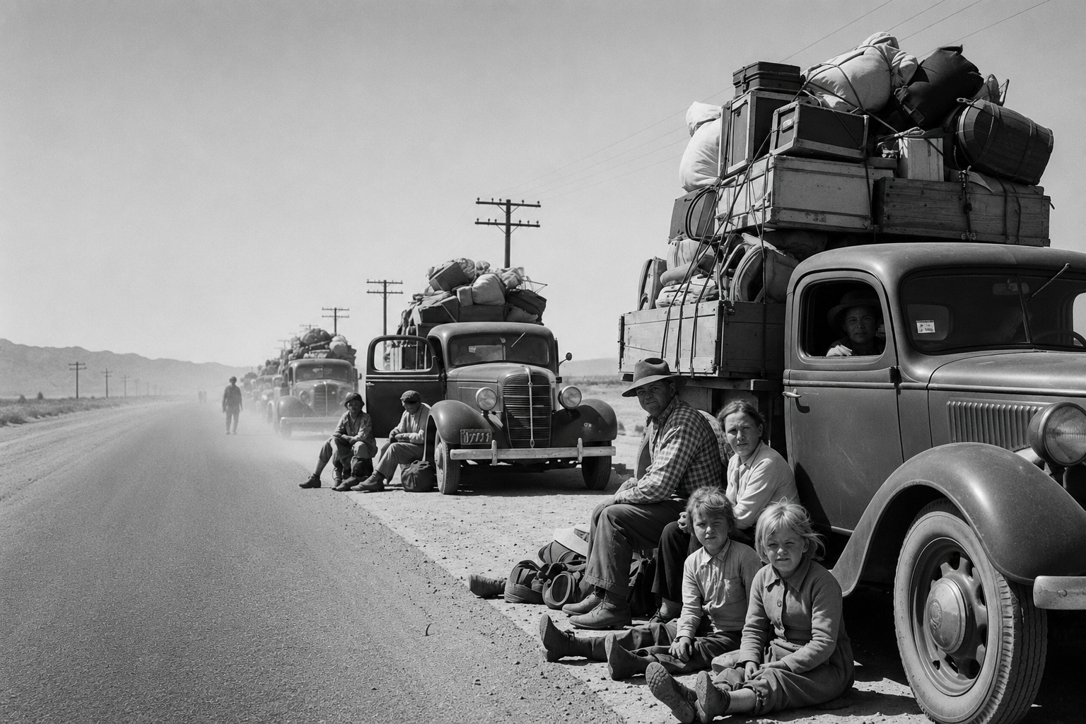
- During the 1930s, thousands of Dust Bowl migrants traveled west on Route 66 toward California seeking work and new opportunities.
- Severe drought, high winds, and soil erosion devastated large parts of Oklahoma, Texas, Kansas, Colorado, and New Mexico during the Dust Bowl years.
- Many migrant families traveled Route 66 in overloaded automobiles, trucks, and farm vehicles carrying all of their possessions.
- Migrants from Oklahoma were commonly labeled "Okies," although many Dust Bowl travelers came from neighboring Plains states as well.
- A notoriously unpaved section of Route 66 in the Texas Panhandle known as the Jericho Gap became infamous during the 1930s for deep mud that frequently trapped westbound travelers during wet weather.
- Service stations, cafés, campgrounds, and roadside businesses along Route 66 often depended heavily on migrant and traveler traffic during the 1930s.
- John Steinbeck immortalized Route 66 in The Grapes of Wrath, published on April 14, 1939. He famously referred to Route 66 as "The Mother Road."
- Steinbeck's reporting on migrant laborers appeared before publication of The Grapes of Wrath.
- The Grapes of Wrath won the Pulitzer Prize for Fiction in 1940.
- Images by Dorothea Lange documented many of the migrant families traveling west during the Dust Bowl era.
Wartime America & the Rise of Car Culture
The Highway at Full Speed
- During World War II, Route 66 played an important military transportation role. Troops and military supplies regularly traveled along the highway.
- Increasing traffic after World War II contributed to severe congestion and rising accident rates along Route 66.
- Near Fort Leonard Wood in 1941, Route 66 saw 454 accidents in just nine months, resulting in 54 deaths.
- Completed in 1942 near Devil's Elbow, Hooker Cut became one of the deepest highway cuts in the United States and one of Missouri's earliest four-lane sections of Route 66.
- Route 66 earned the nickname "Bloody 66" because of the high number of serious and fatal automobile accidents along the narrow two-lane highway.
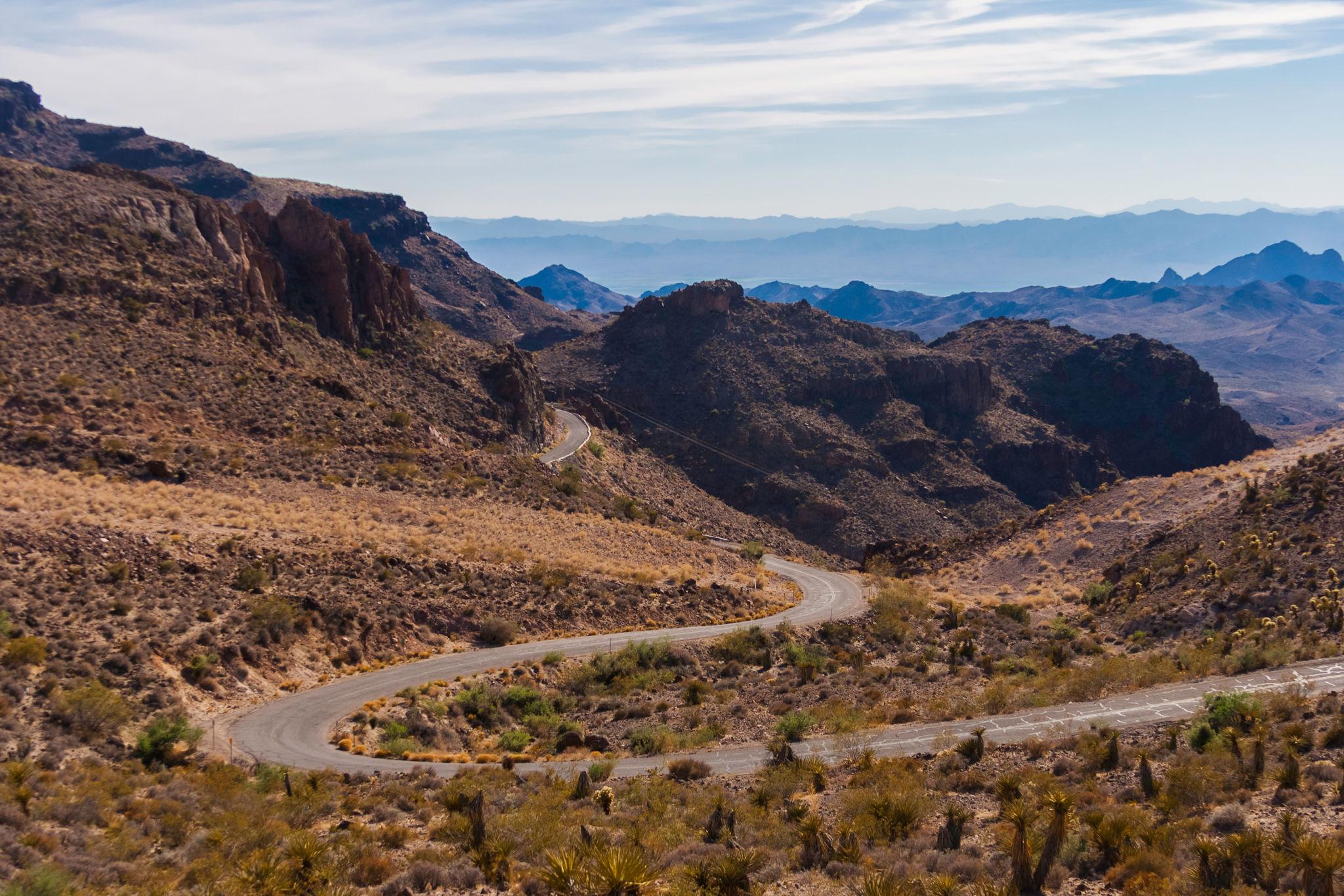
- Sections of Route 66 near Peach Springs, Oatman, and Devil's Elbow became especially notorious for deadly accidents.
- The winding mountain section through Sitgreaves Pass near Oatman was considered so dangerous that some travelers reportedly hired local drivers to navigate it for them.
- After WWII, Americans embraced automobile travel like never before. By the 1950s, Route 66 had become one of the busiest two-lane highways in the United States.
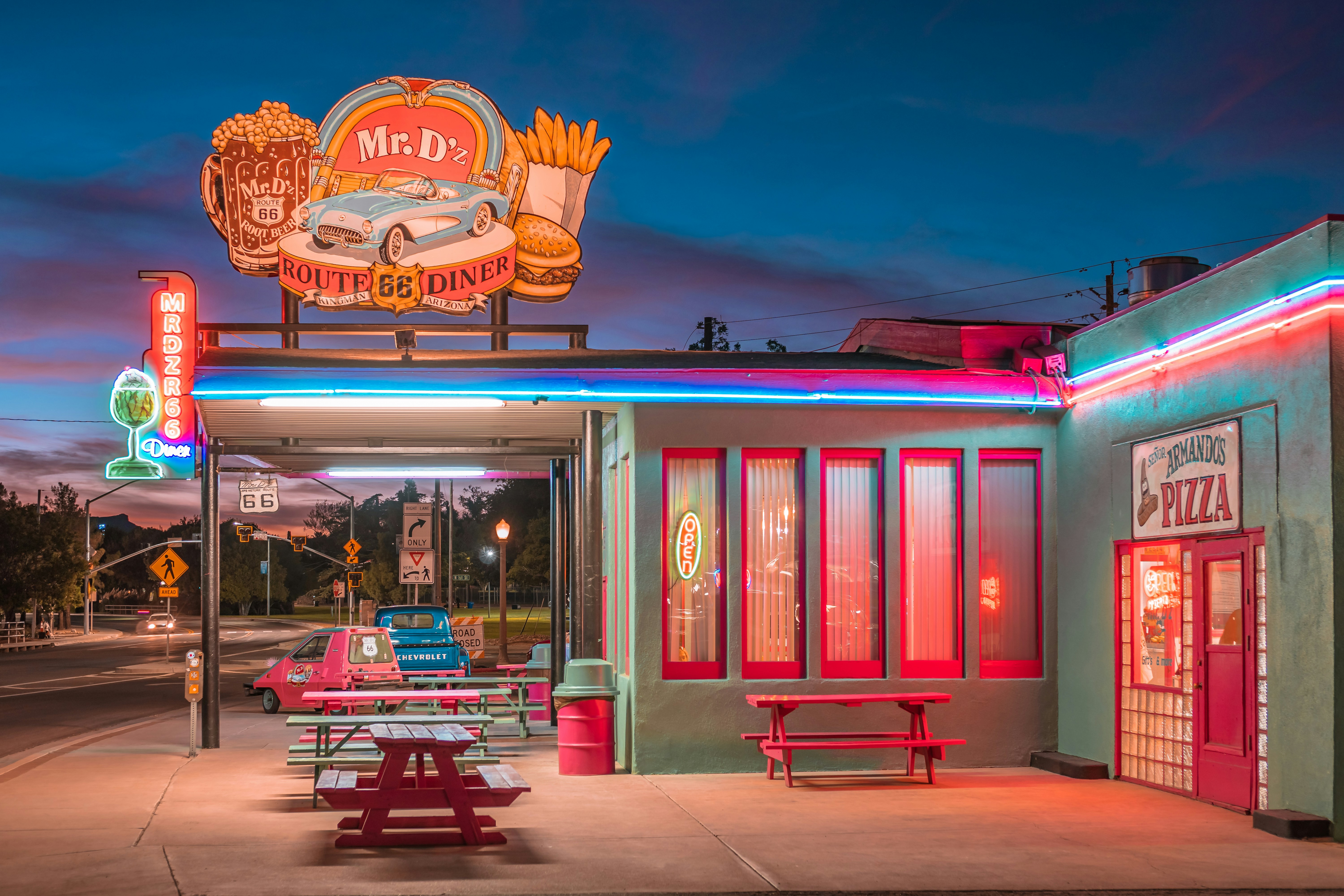
- By the 1950s, roadside motels, neon signs, drive-ins, and service stations had transformed Route 66 into one of the defining symbols of postwar American car culture.
- In 1956, construction began on the Interstate Highway System, which would eventually bypass much of Route 66.
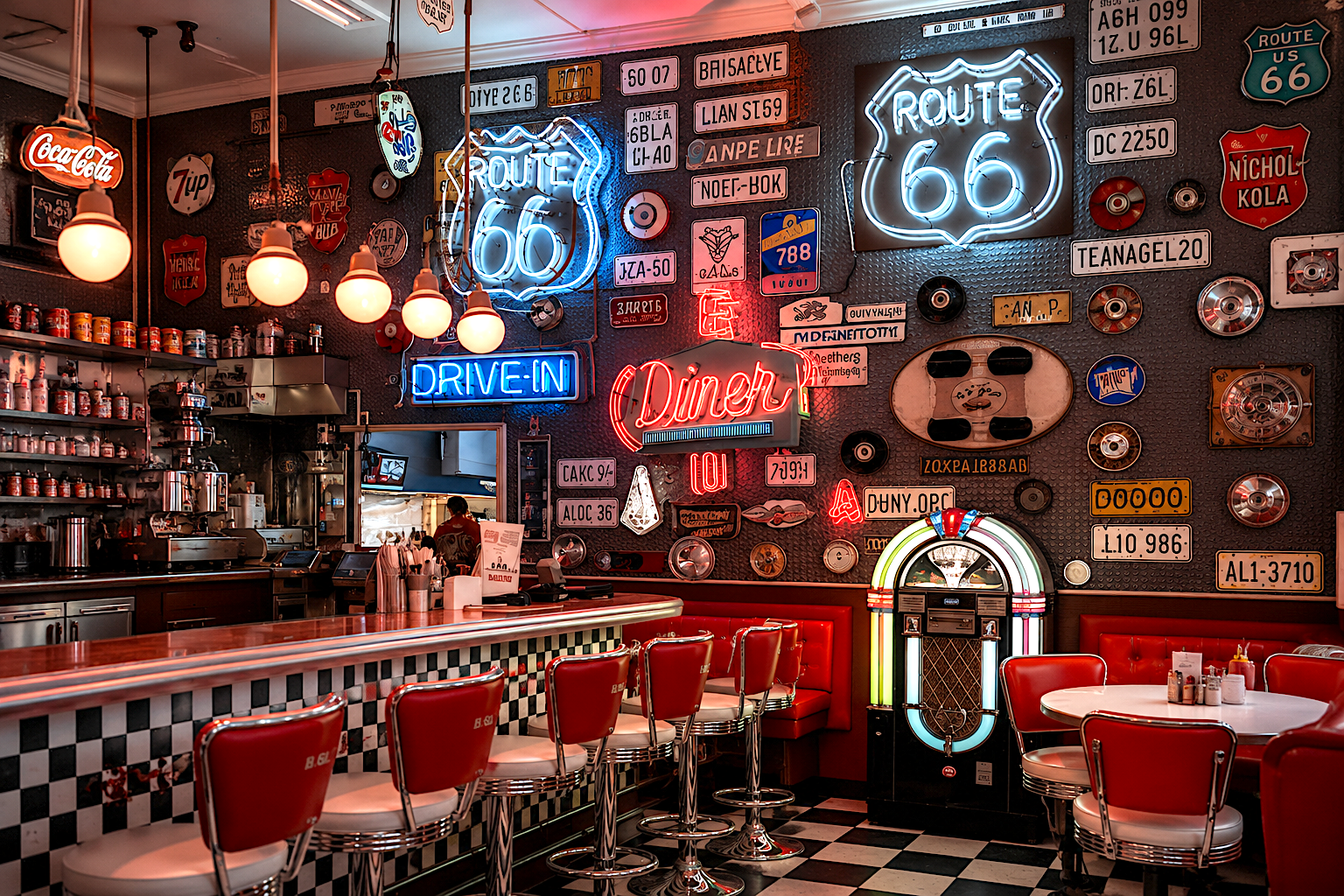
The Golden Age of Route 66
Neon, Motels & Americana
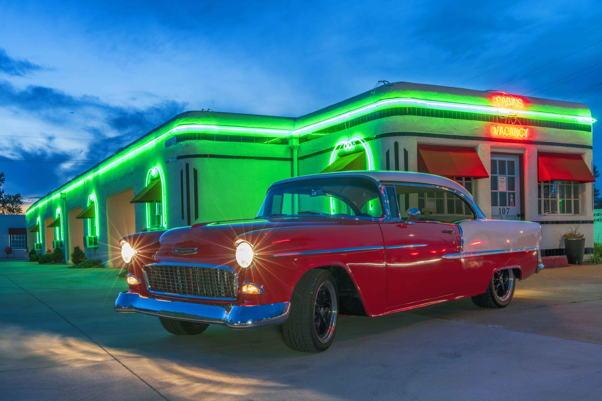
Photo Credit: Boots Court
- The famous Phillips 66 gasoline company reportedly chose its name after a test drive reached 66 miles per hour in 1927.
- Blue Swallow Motel opened in 1939 and remains one of the most famous operating motels on Route 66.
- Boots Court Motel opened in 1939 and became known for offering air conditioning and radios in every room.
- Clanton's Cafe opened in 1927 and remains one of the oldest continuously operating restaurants on Route 66.
- Snow Cap Drive-In opened in 1953 and became one of the most beloved roadside stops on Route 66. Snow Cap Drive-In founder Juan Delgadillo became famous for playing practical jokes on Route 66 travelers.
- Roy's Motel & Café opened in 1938 and became one of the most photographed neon landmarks on Route 66.
- Giant roadside statues known as "Muffler Men" began appearing along Route 66 during the 1960s. Gemini Giant in Wilmington, Illinois became one of the best-known surviving Muffler Men on Route 66.
- Blue Whale of Catoosa was built in the early 1970s by Hugh Davis as an anniversary gift for his wife, Zelta.
- Wigwam Village No. 7, opened in 1949 in San Bernardino, California, and Wigwam Village No. 6, opened in 1950 in Holbrook, Arizona, became two of the most recognizable examples of teepee-shaped roadside architecture along Route 66 and remain among the few surviving Wigwam Villages in the United States.
- Jack Rabbit Trading Post opened in 1949 along Route 66, and its famous "Here It Is" billboards began appearing soon afterward to attract motorists traveling across northern Arizona.
Pop Culture & International Fame
How Route 66 Captured the Imagination
- Bobby Troup reportedly began writing "(Get Your Kicks on) Route 66" after his wife, Cynthia, suggested the phrase during their cross-country drive.
- Nat King Cole helped popularize the song nationally after recording it in 1946.
- The song has since been recorded by dozens of artists including Chuck Berry, The Rolling Stones, and Depeche Mode.
- Route 66 TV series aired from 1960 to 1964 and was filmed largely on location across America.
- The Route 66 highway shield became one of the most recognizable and widely reproduced road symbols in the world.
- Easy Rider and other road-trip films helped reinforce Route 66's association with freedom and the open road.
- The 2005 Pixar movie Cars introduced a new generation of international audiences to Route 66 culture and roadside Americana.
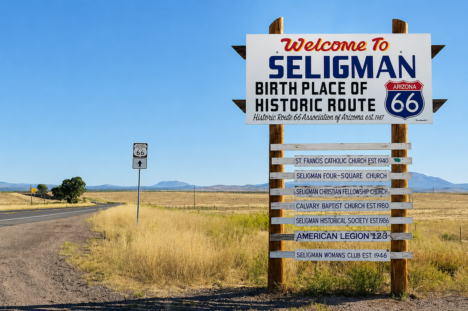
- The fictional town of Radiator Springs in Cars drew inspiration from Route 66 communities including Seligman, Arizona.
- International tourism along Route 66 increased significantly during the late 20th century revival movement. International visitors from countries including Germany, Japan, France, Italy, Australia, and the United Kingdom now make up a significant share of Route 66 tourism.
- The National Park Service estimates Route 66 attracts approximately 2.5 million visitors annually.
Bypassed by the Interstate
The Decline of the Mother Road
- In 1956, President Dwight D. Eisenhower signed the Federal-Aid Highway Act, launching construction of the Interstate Highway System.
- Large sections of Route 66 were redesignated as business loops, frontage roads, or county roads after interstate construction.
- On September 22, 1978, Interstate 40 officially bypassed Seligman.
- The bypass of Seligman became one of the defining moments of Route 66 and helped inspire preservation efforts across all eight Route 66 states.
- Williams became the last Route 66 town bypassed by Interstate 40 when the final section of the freeway opened on October 13, 1984.
- Route 66 was officially removed from the U.S. Highway System on June 27, 1985.
- Illinois was the first state to remove Route 66 road signs. The final Illinois Route 66 sign was officially removed on January 17, 1977.
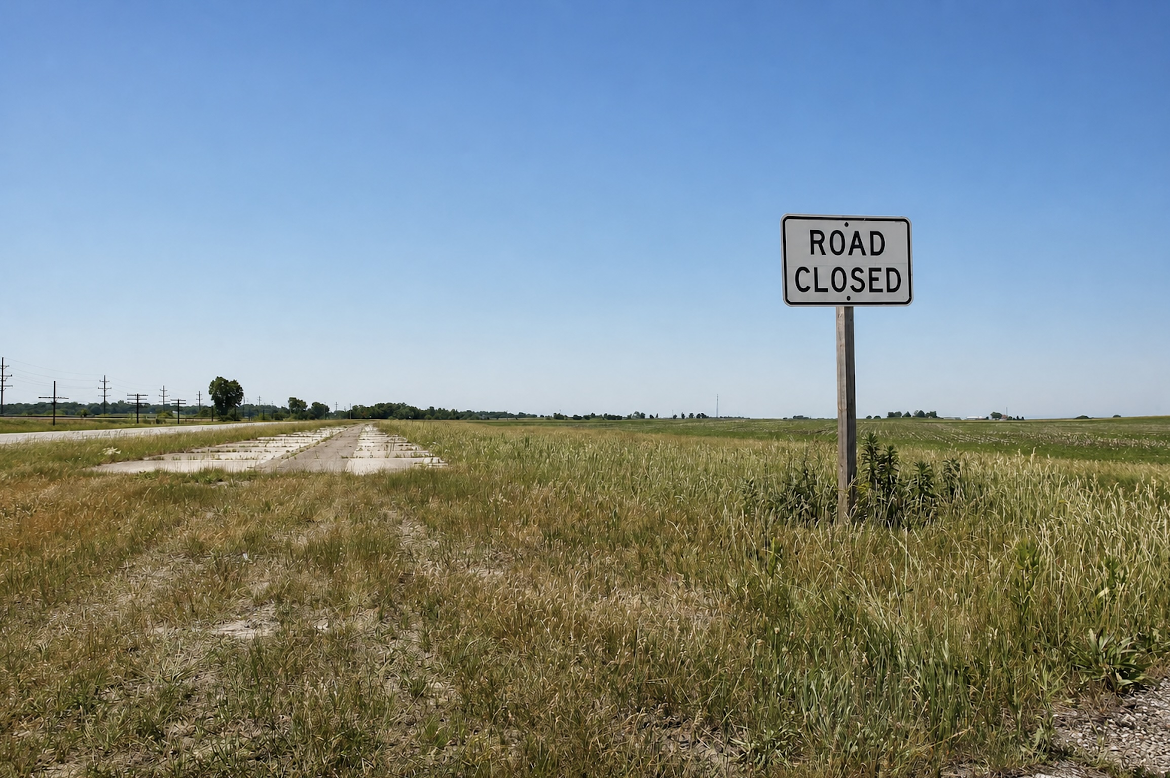
- Abandoned stretches of Route 66 such as Hext, Oklahoma and Carpenter Park Trail along the Sangamon River in Springfield, Illinois, still preserve original remnant pavement from the highway's pre-interstate alignments.
- Despite decommissioning, more than 85 percent of original Route 66 remains drivable today.
- In 1987, Arizona became the first state to designate a section of "Historic Route 66," helping launch the highway's modern preservation movement.
The Preservation Movement
Saving the Mother Road
- After Interstate 40 bypassed Seligman in 1978, Angel Delgadillo began promoting Route 66 tourism to help save the town's economy.
- The Historic Route 66 Association of Arizona was founded in 1987, and Arizona became the first state to officially designate a section of "Historic Route 66."
- Historic Route 66 associations now exist in all eight Route 66 states.
- Missouri became one of the first states to install "Historic Route 66" road markers during the early preservation movement.
- The California Historic Route 66 Association, established in 1990, became the youngest of the eight state Route 66 associations.
- Beginning in the 1990s, international Route 66 associations and enthusiast clubs formed in countries including Japan, Germany, and the Czech Republic as the highway's global popularity continued to grow.
- The National Historic Route 66 Federation was founded in 1995 to coordinate preservation efforts across the entire highway.
- The National Park Service launched the Route 66 Corridor Preservation Program in 1999 to help fund restoration projects involving motels, neon signs, museums, and historic Route 66 structures.
- In 1999, Congress authorized up to $10 million in matching grants through the National Route 66 Preservation Program to help restore historic Route 66 properties and businesses.
- By the early 21st century, Route 66 had become one of the most widely recognized historic highway preservation efforts in the United States.
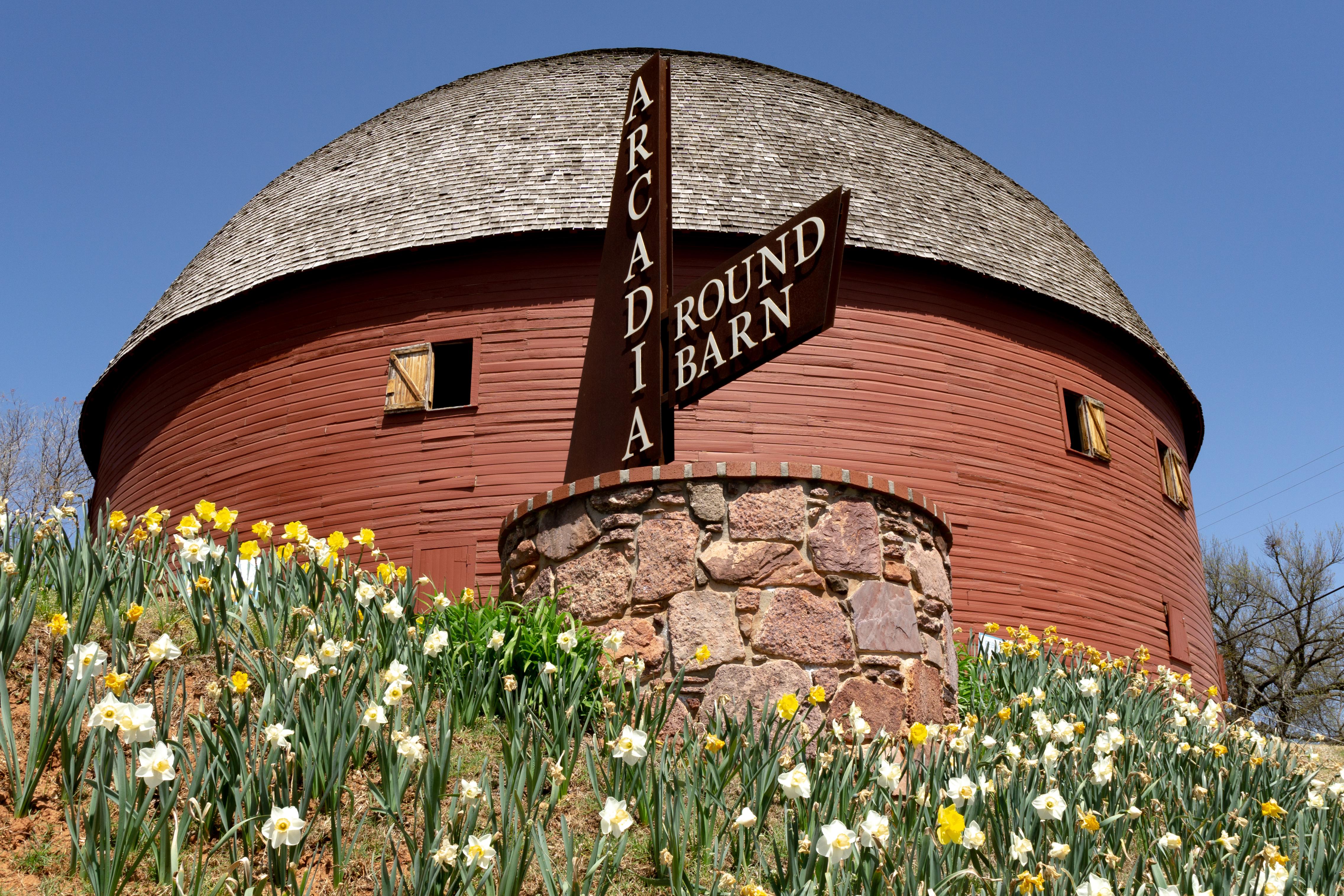
Icons of the Mother Road
Landmarks That Became Legends
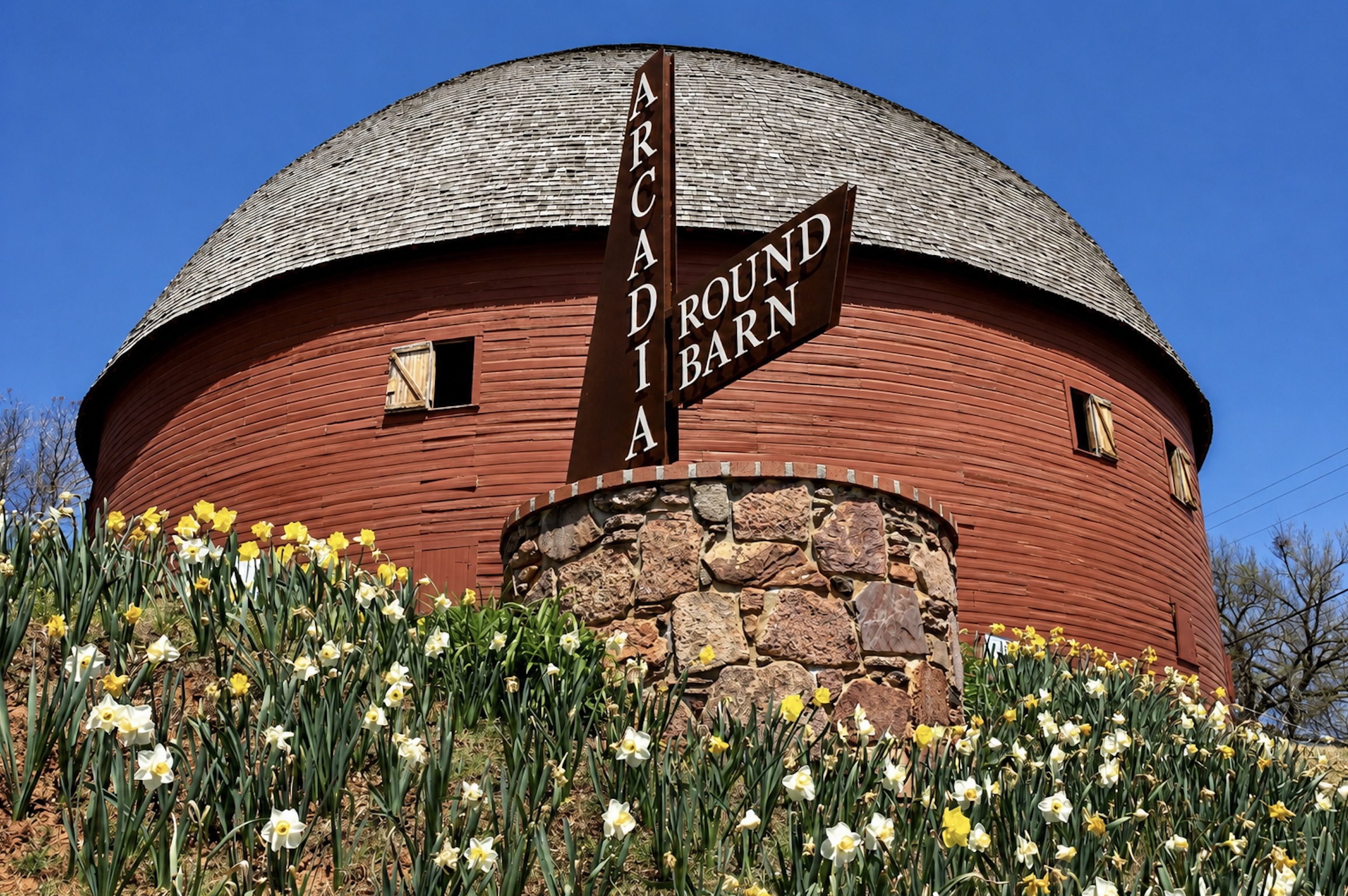
- The Round Barn in Arcadia, Oklahoma, originally built in 1898, became one of Oklahoma's most recognizable Route 66 landmarks after its restoration.
- Elmer's Bottle Tree Ranch in Oro Grande, California, transformed discarded glass bottles and metal into one of the most photographed folk art stops on Route 66.
- Totem Pole Park in Foyil, Oklahoma features some of the world's largest concrete totem poles near Route 66.
- MidPoint Cafe and its Route 66 Midpoint Sign mark the halfway point of Route 66 — 1,139 miles from both Chicago and Los Angeles.
- Chain of Rocks Bridge, spanning the Mississippi River north of St. Louis, features an unusual 22-degree bend midway across the span, making it one of the most distinctive bridge designs on Route 66.
- Devil's Elbow Bridge in Missouri remains one of the oldest surviving steel truss bridges on Route 66.
- Petrified Forest National Park is the only national park containing a Route 66 alignment.
- La Posada Hotel became one of the last great Fred Harvey railroad hotels preserved along the Route 66 corridor.
- Tucumcari, New Mexico became famous along Route 66 for its glowing vintage neon motel signs and the longtime tourism slogan "Tucumcari Tonight!" The city once promoted itself as having "2,000 Motel Rooms" available for travelers crossing the Mother Road.
- Route 66 Centennial celebrations officially began across all eight states in 2026, marking 100 years since the highway's establishment on November 11, 1926.